Map 1 - width=85 mi
Map 2 - width=28 mi

Map 2 - width=28 mi
Map 3 - width=14 mi

Map 3 - width=14 mi
Map 4 - width=6.7 mi

Map 4 - width=6.7 mi
Go to Pte. Mouillee maps.
Return to the Pte. Mouillee bird checklist page.
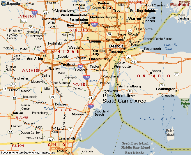
Map 1 - The Pte. Mouillee State Game Area is near the town of Rockwood, Michigan, south of Detroit at the northwest corner of Lake Erie. It is approximately equidistant from Southfield, Ann Arbor, and Toledo--35 to 40 miles driving distance. The large island south of Wyandotte is Grosse Ile (in the Detroit River). Pte. Mouillee is just a few miles south of Grosse Ile along (and east of) a road known and marked as both U.S. Turnpike Rd. and W. Jefferson Ave.
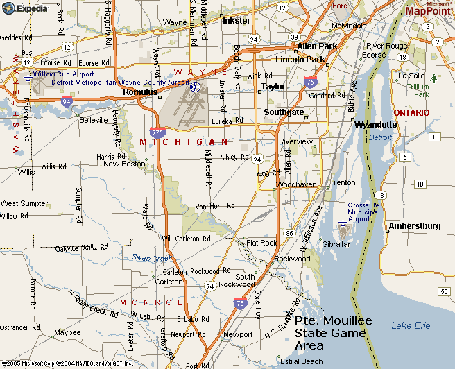
Map 2 - Pte. Mouillee SGA is about a mile south of Lake Erie Metropark, the green area east of Rockwood. Pte. Mouillee extends from Sigler Rd. on the north (approximately the location of "Rd." of "U.S. Turnpike Rd." on the map) southward to just north of Estral Beach. What looks like an island just north of Estral Beach is actually Cell 1, the south cell, of "the Banana" at Pte. Mouillee.
In this map each small square is one mile on a side.
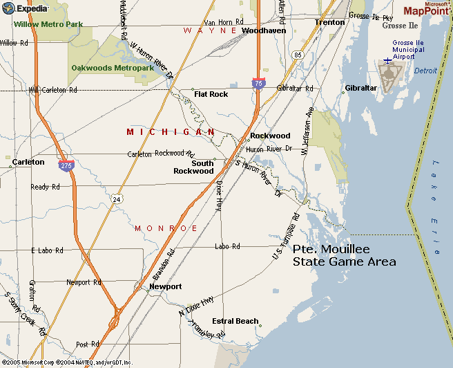
Map 3 - An east-west road not shown on this map, Sigler Rd. (see Map 4), marks the north end of Pte. Mouillee. Sigler Rd. is halfway between Ready Rd. and Labo Rd., one mile from each. It ends at a parking lot at approximately the "Rd." of "U.S. Turnpike Rd." on the map, near the north end of the large inlet.
Much of the Pte. Mouillee area shown as water on this map and the others is marsh, not a part of Lake Erie.
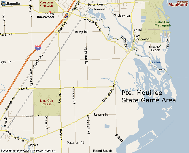
Map 4 - From the north end of Pte. Mouillee SGA (Sigler Rd.) to the south end is about three miles. The south end is Cell 1 of "the Banana". What looks like an island on this map is Cell 1. It is connected by a short causeway from the Roberts Rd. parking lot. The five-cell Banana, each cell almost a mile in length, is traced out in part on this map.
Campau Rd., not shown here but off U.S. Turnpike one mile north of Sigler Rd., leads east and south to the Pte. Mouillee SGA headquarters, located almost directly east of the Sigler Rd. parking lot. There is a large parking lot there and open views of water in three directions. Depending on season this is a good location for viewing waterfowl, gulls and terns, and raptors.
All Pte. Mouillee SGA units and separating dike roads are shown on accompanying maps.
Click on any map below to get a separate, printable version.

Map 2 - width=28 mi

Map 2 - width=28 mi
Map 3 - width=14 mi

Map 3 - width=14 mi
Map 4 - width=6.7 mi

Map 4 - width=6.7 mi
Go to Pte. Mouillee maps.