HOME
|
HOME |
|
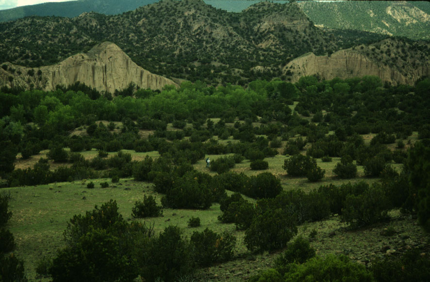
The Rio del Oso is located
approximately 20 miles north of Espanola, New Mexico in the Santa Fe National
Forest. The Rio del Oso Valley is characterized by riverine habitats
surrounded by plateaus and low hills. Uplands are dominated
by pine while the lower reaches of the valley represent a mosaic including
pinyon-juniper open woodland, juniper grassland, and riverine habitats.
The valley has been occupied for approximately 7,000 years, first by Archaic
hunter-gatherers, then by Puebloan farmers, and finally by historic tipi-dwelling
Native American and Hispanic communities during the 1800s.
The Ute, Navajo and possibly Comanche Indians were reported in this general
area during the 1700s and early 1800s. At least one band of
the Jicarilla Apache permanently settled in the Rio del Oso starting in
the mid 1800s just before they began accepting U.S. government rations
at Abiquiu just 15 miles north of the valley. The following photographs
were taken of a group of closely aggregated sites probably representing
one or several permanent base-camps (LA90813, LA90814, LA90815) believed
to be occupied by the Jicarilla at this time. These conclusions are
based upon historical records that state at least 39 nine Jicarilla lodges
were established in the valley during the 1850s. Conclusions
are also based the presence of multiple tipi rings (~40), evidence of micaceous
clay pottery production, Apache micaceous sherds, distinctive beveled and
one-handed manos, Apahcean projectile points, and historical artifacts
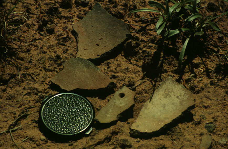
dating to the 1800s found on these three sites. Several sherds retrieved
from these sites were made from clays derived from the Petaca clay district.
Shot of LA90813 looking south.
Tipi ring at LA90815
Historic wagon road (LA90813)
Apache point
Micaceous sherds (LA90814)
Mica Schist and quartz "debitage" or waste possibly related to clay cleaning of mica clays. Scatters like this are localized, occurring primarily at
the borders of tipi rings on the site.
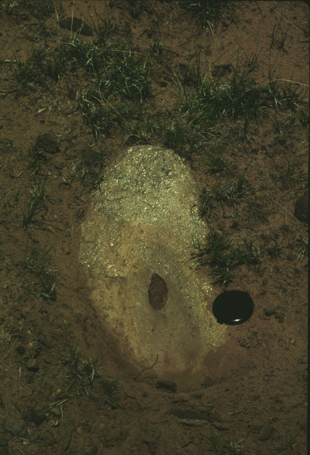
Mica Schist metate (groundstone) with unknown function (LA90815) Note that this groundstone has been ground completely through. Mica was used ethnographically by tribes in this area as body decoration, suggesting
one possible function for this piece.
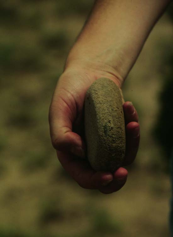
Mano or grinding stone (LA90815) found inside a tipi ring feature. Lateral beveling can be seen as a slight discoloration
along its margin.
This photograph shows metal clippings distributed in a tight cluster on the border of one tipi (LA90815). Historically, Jicarilla were known for their production of metal points cut and hammered from barrel hoops.
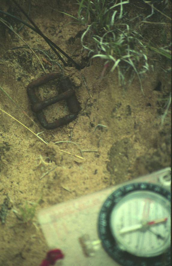
Historic belt buckle dating to the latter 1800s (LA90813). Found near a tipi ring.
An exploratory metal detector survey was conducted across all three sites (LA90813, LA90814, LA90815) during the summer of 1998 by Charles Haecker, Dick Ford, and Sunday Eiselt. Buried Metal artifacts were located in discrete areas related to activities on the site.
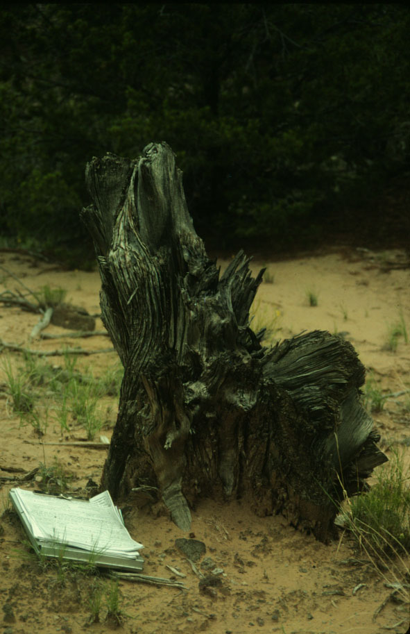
Axe-cut juniper stumps such as this one are common on these sites, and are common in historical photographs of Jicarilla camps. Juniper tree-ring dating may possibly provide information regarding the timing and duration of site occupation.
|