...BUT NOW THEY ARE IDENTIFIED BY THE COMPUTER
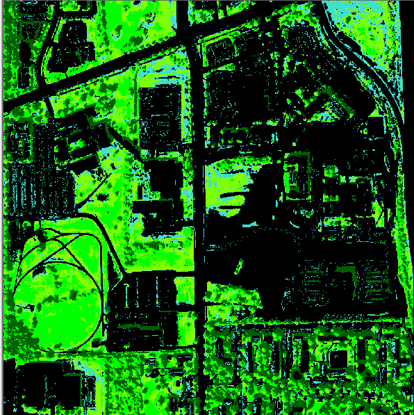
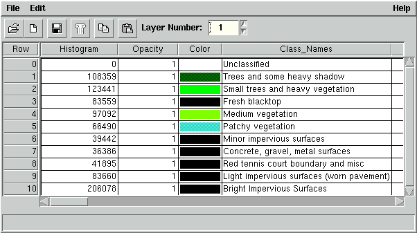
Areas classified by Imagine as impervious accounted for 491,020 of the 886,402 pixels in the scene representing 55.4 % of the land cover or approximately 4,410,216 m²
(441 ha).
What about Landsat MSS?...