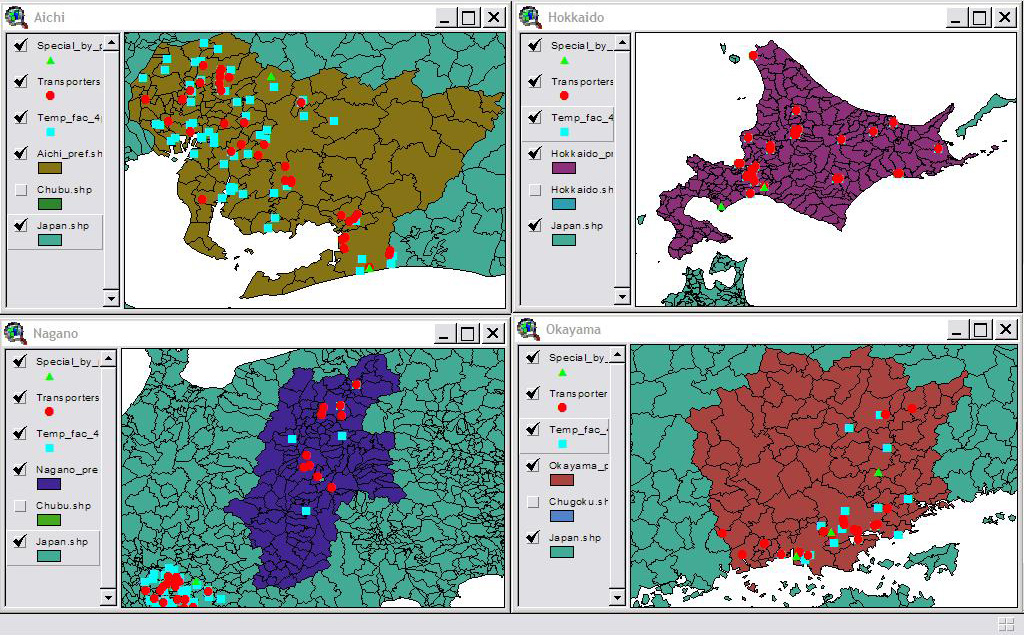
The blue-green areas are the neighboring prefectures and the white areas correspond to water regions.
Conclusions
Based on these maps it is evident that Nagano, the prefecture
that is both not a part of a highly industrialized region and unsurrounded
by water has the least amount of hazardous waste facilities. For
one, there are no permanent facilities and even the number of temporary
and transporter waste facilities are much less than the other regions.
Also, it seems that in the other regions, namely in Aichi and Okayama,
many of the facilities are densely located nearer to oceanside areas rather
than nearer to the inner land regions. Aichi and Okayama are also
the areas that are most densely industrialized. Hokkaido, on the
other hand, which is more agricultural, also has a good number of waste
facilities including a few permanent 'specially controlled waste disposal
facilities,' but they are pretty spread out over a larger area, throughout
the entire region. There is one noticeable cluster in Hokkaido that
may be interesting to look into further. Hokkaido, may therefore
be one very interesting area to start a more in depth type of study. From
my preliminary study results, it is evident that there may be some very
interesting correlations with respect to the siting of 'specially controlled
waste disposal facilities' in Japan. For the most part, though, further
investigation is needed, especially by merging in some analysis related
to the demographic/census data in these areas.
THE END............for now.