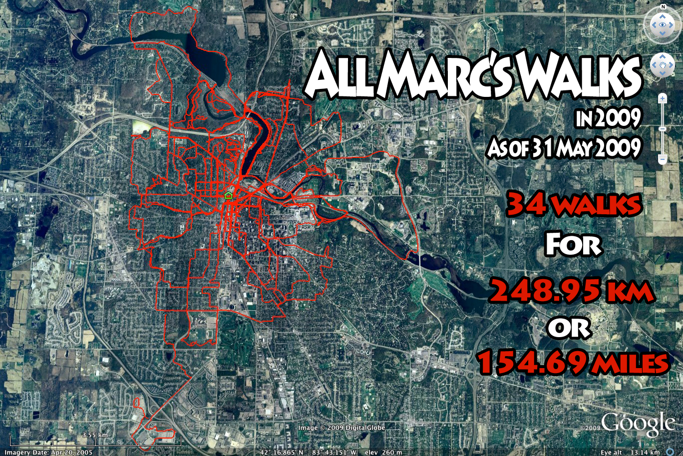
I became interested in geocaching in August of 2008 and was immediately hooked. Geocaching is a world-wide game of hide and seek, where finding hidden 'treasure' is the primary goal.
Geocachers hide containers of all shapes and sizes (anything from 'nano' sized film canisters up to large ammo canisters and storage boxes) somewhere in the world an then use their GPS receivers to geolocate the spot. Those coordinates and a description of the geocache are placed on the Internet at various sites, the most popular being Geocaching.com.
Other players then use the web site to find the coordinates for geocaches in a given area and download those coordinates to their GPS receivers. With GPS in hand, the hunt is on!
Using the tools built into their GPS receiver, the geocacher navigates to the location of the hidden geocache. Usually GPS coordinates can get the geocacher within a dozen meters/yards or so of the hiding spot, after which the geocacher must use the description of the geocache and any clues provided to locate the actual container. Some are easy and some are devilishly hard.
A variety of items are placed in geocaches, depending upon the size of the container. A magnetic keyholder nano geocache usually has no space for anything but a logbook, while large containers can hold all manner of trading items. The idea is to locate the geocache, sign the logbook, then if one wishes, take one of the trade items out of the geocache and place an item of similar value into the geocache. There are also items that are meant to travel to other geocaches. These 'travelbugs' are also tracked on the geocaching.com website, and offer another aspect to the gameplay. For example, I have placed several travelbugs into the game, my favorite being a 'geocoin' issued by the Michigan Geocaching Organization.
Urban geocaching is made more difficult by many more non-geocaching people around. One of the rules of geocaching is that a geocacher should do their best to avoid having 'muggles' (people who are not playing the game) see them remove a geocache from it's hiding place.
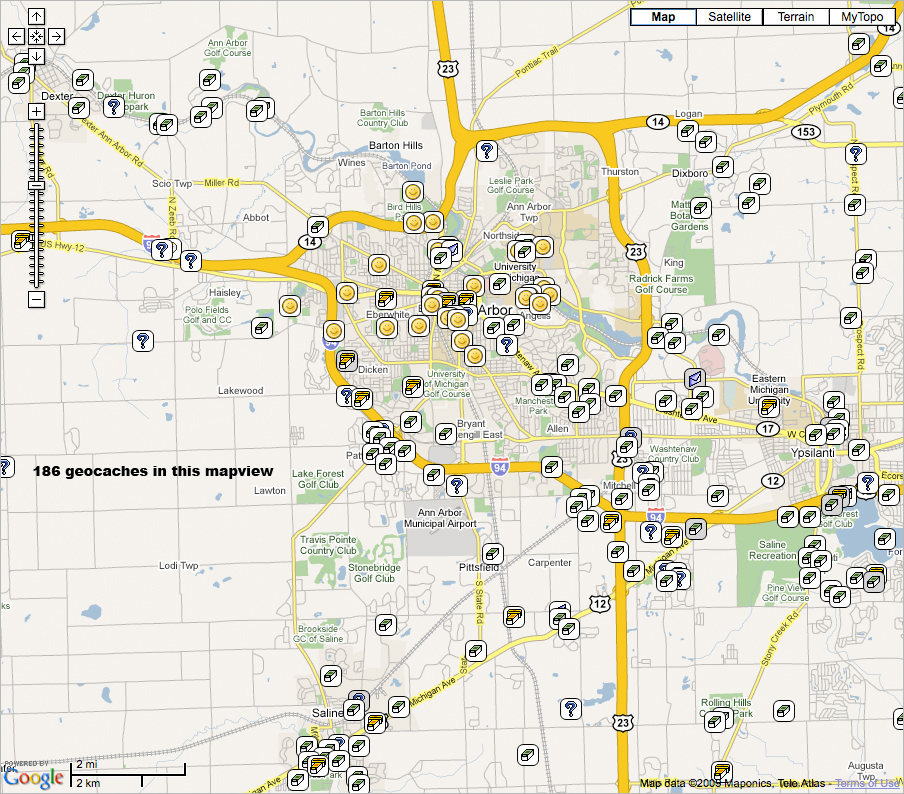
There are almost 200 geocaches within a 10km radius of downtown Ann Arbor, so even if I limit myself to local geocaches, I still have a lot of hunting ahead of me.
In addition to geocaches, I also enjoy locating USGS benchmarks. Benchmarks are usually small metal discs set into concrete blocks or other less-than-moveable objects that were used to survey the terrain when the United States Geological Survey mapped the area. Many of these benchmarks still exist and can be located in the same way that one locates a geocache.
|