Understanding Social Connectivity In Disaster Recovery
During a disaster, the most vulnerable communities are often disconnected from the decisions and processes that impact their ability to recover. Our work considers how planners, community organizers, and nonprofit leaders can work together to accurately assess community needs and coordinate equitable emergency response.
Identifying Community Needs and Network Structures for Equitable Recovery
Through field visit observations, interviews, and extensive research on the limitations of current disaster response methods, our research team learned that disaster response is often driven by networks of community leaders who provide support, information, and resources to households when the presence of federal aid is no longer available.
Conversations with community leaders also indicated that geographically and socially vulnerable communities still do not receive the adequate support or aid needed for equitable and resilient recovery. Therefore, as emerging disaster management policy and technology continues to evolve, it is imperative that the consideration of community networks and locally-identified assets are included in disaster planning models. This understanding has guided our efforts to consider how effective community engagement and network analyses can create disaster preparedness and response methods that leverage the assets and relationships found within local communities.
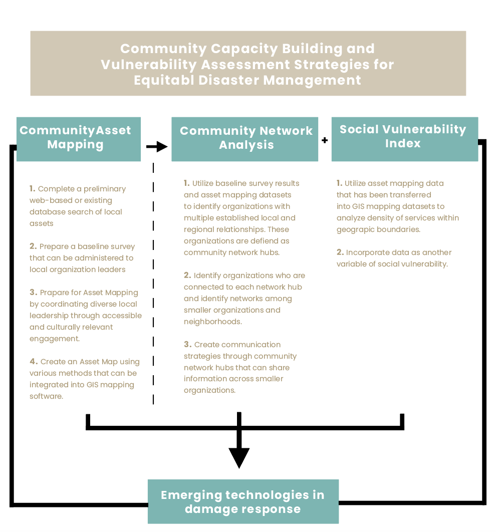
This page contains an overview of select strategies to build on the significance of community network building and vulnerability assessments within disaster preparedness and recovery frameworks. It also hosts opportunities to merge these insights into applications for emerging damage assessment technologies.

View the Community Asset Mapping Documentation
Community Asset Mapping
Integrating community asset identification into emergency preparedness and vulnerability assessment frameworks for equitable and resilient disaster management.
Case Study: St. Charles Parish
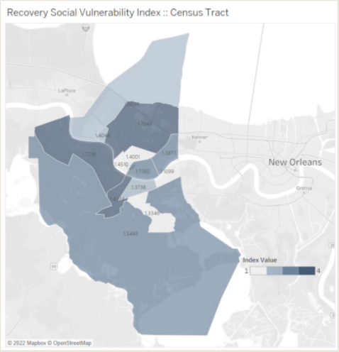
In the map below is a visualization of an asset map for St. Charles Parish. Each asset is marked on the map with a colored point corresponding to the category of service provided. These points are shown on the map along with parcel boundaries. For this particular analysis, the number of assets within 1.5 miles of each parcel has been calculated for each parcel. When visualized, this can show us the location of resource rich areas (shown in dark yellow) and resource poor areas.
Why create an asset map?
Asset mapping is the process of documenting key services and resources within a community, such as individuals’ skill sets, organizational resources, physical spaces, sacred spaces, local environmental systems, and local institutions. Through this process, communities can better understand the landscape of organizations, resources, and leadership present within the region in addition to possible geographic or social vulnerabilities that may be acting as barriers to disaster preparedness and recovery capacity.


